-
How to spend a week in the Upper Arkansas
River Valley/Sawatch Range of Colorado
Where are you going?
The Arkansas River begins in the Mountains around
Leadville Colorado, which is one of the highest elevation
cities/towns in the US. The valley that contains the first
70 miles or so of the river is in the central part of
Colorado, running more or less North-South, about 100 miles
west of Denver, Colorado Springs and Pueblo. The valley is
broad, say 20 miles across near Leadville, narrows to a
gorge (downstream about 20 miles) at Granite, then gradually
broadens again to about 15 miles across as the river runs
down to Salida. There the Arkansas enters an extended series
of narrow valleys and gorges, the last of which is the
"famous" Royal Gorge near Canyon City.
The Eastern side of the valley is bounded by the Tenmile/Mosquito
Range, a mining district, and the Western side is Bounded by
the Sawatch Range, also famous for mining, but more famous
now for having the most accessible 14’ers (mountains above
14,000 ft) in Colorado. The three main towns in the valley
are Leadville in the North, Buena Vista in the center and
Salida in the South.
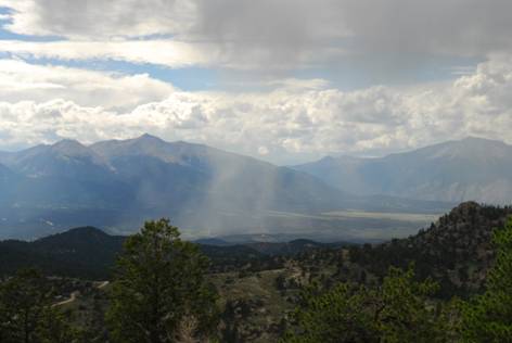
This photo was taken from the mountains in the East,
looking over the valley and onto the Sawatch Range in the
West. See the rainstorm? 2006 was the rainiest year
we’ve seen here.
The mountainous areas on the East and West are largely
public land, either BLM or National Forest. The valley floor
itself is where most private property is. You’ll likely find
accommodations around the major towns, or possibly in one of
the "rural residential" housing developments in the valley.
Because of the high mountain range to the west, the valley
has a mild (since air flowing downslope warms) and dry
climate. Typical daytime high temps in the summer on the
valley floor are in the low 90’s with negligible humidity.
Nighttime lows are in the 50’s and 60’s. As you go up in
elevation, the temps all get cooler. Because mountains make
their own weather, it’s often impossible to exactly predict
what weather you’ll get on any given day. The usual mid-late
summer weather pattern starts off cool and clear in the
morning, with a few white puffy clouds by noon, and isolated
thunderstorms by late afternoon/early evening. In dry years,
there may be no storms or rain. In wet years, such as 2006,
you might have rain every single day.
What is there to do?
While we haven’t tried every possible thing you can do in
this area, we’ve tried a lot of them. Some of the activities
are quite "touristy" and of course that’s where you’ll find
the most people (I didn’t say crowds because I don’t think
I’ve ever seen a real crowd here). Other activities range
from mildly active things to extremely active things. I’ll
start with the laziest and work my way up to the more
strenuous activities.
Museums and sightseeing:
In the valley itself, the best museum I know of is the
mining museum in Leadville. I’ve personally never been in,
but have been told it has a fantastic mineral collection as
well as all sorts of interesting history of the area.
Leadville also has a train ride that runs from downtown, up
to one of the mountain passes to the Northeast and back.
It’s not the most "authentic" experience, as they use a
diesel locomotive instead of steam, but it will keep kids
entertained for 3 hours and if it’s a hot year the ride goes
from 10k ft to 12 kft, so the temps will be cool.
Canyon City is about an hour and a half drive southeast
of Salida, and from there you can catch the Royal Gorge
train, about a 3 hour train ride up through the Royal Gorge
and back. Or, not going all the way to Canyon City, you can
stop at the tourist trap Royal Gorge Park. If you have the
$$, take the helicopter tour of the Gorge, you can’t miss
the heliport on US50…
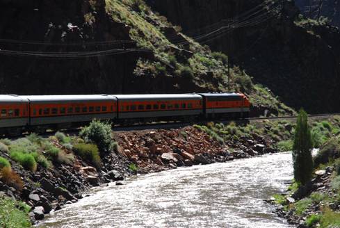
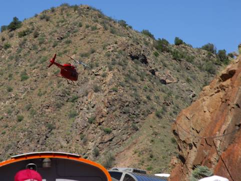
The helicopter pilot likes to buzz the train…
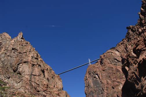
Highest suspension bridge in the world, wanna bungee jump
with Christi?
Light activities:
For these, I’m assuming you are willing to do a little
walking, but no real "hiking" or climbing or anything that
down at sea level would cause you to breathe hard (because
if you are not in shape, until you have built some altitude
acclimatization, just walking up a small hill will have you
out of breath at 10,000 ft.). So mostly these things are
"drive there and then get out and walk around a bit" type of
things.
Also, with a little luck and foresight, you can find
housing accommodations that have access to walking trails
and such, and we always try to have a little elbow room
wherever we stay.
There are many scenic locations that you can drive to
from the valley, and usually these get better if you are
willing to take a few hundred steps away from your car.
Starting in the south is the area around Poncha Pass,
ultimately leading to Marshall Pass (40 minutes further on a
dirt road). There are a series of well maintained dirt roads
to the east of Salida (you’ll hear more about them later).
If you take them far enough in, you’ll cross over the
southern end of the mosquito range into the South Park basin
(think the TV show!). The western side of this range is
mostly desert grading into juniper/ponderosa pine, but the
higher elevations have nice open valleys with aspen trees
and cool breezes.
About halfway between Salida and Buena Vista is Colorado
hwy 162 which goes to St Elmo. St Elmo is a partly restored
(former) ghost town. Every year more and more of the
original (and I imagine not so original) aspects of the town
get rebuilt.
Kids love it because there’s a place where there’s a
large population of little ground critters (squirrels and
chipmunks and so forth) that are very friendly. You can sit
on the benches and they’ll crawl all over you in hopes that
you’ll feed them. You can buy sunflower seeds right across
the street. A little bit of walking will show you some good
examples of late 1800’s mountain architecture.
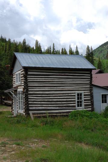
St. Elmo building…
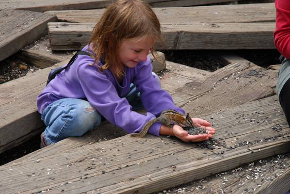
Chipmunk…
At the top of my favorites list for a way to spend a day
in relative relaxation is fishing. The Arkansas river itself
is popular with the serious fishermen, and the fishing is
good for large trout if you know what you are doing, which
means you are an expert fly fisherman, which I’m not by any
means. The serious fishing happens before the spring runoff,
and after the summer weather pattern shuts down and temps
get cooler. So, instead we’re looking for that "lazy"
fishing that mostly consists of sitting by the side of a
mountain lake and relaxing. The tourist brochures for the
area list several area lakes that have fair to decent
fishing. We’ve caught fish in every one of them, but over
the last 6 years have perfected our techniques. The smaller
lakes up US 50 towards monarch pass have good fishing in the
evenings for small trout. The best day-outing I know is to
take a canoe or kayak to Cottonwood lake west of Buena
Vista. The lake is maybe 1/2mile long and 1/5th
mile across, nice mountain setting. The edges of the lake
see a fair number of fishermen (locals) but from a paddled
boat you can fish the entire lake. What I usually do is sit
one (or two small)child(ren) in the front of my tandem kayak
and have them troll while I gently paddle. I give each child
one lap of the lake to catch as many as they can. Last year
or total number of fish brought to the boat (we catch and
release since the kids don’t eat fish) was just under 50 in
about a 4 hour period.
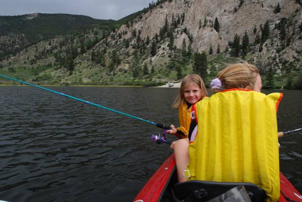
Here’s Christi and Carina fishing (Fish don’t bite when
girls talk)
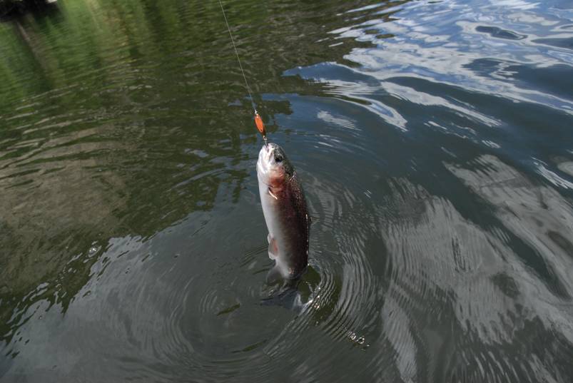
Here’s Carina’s fish…
Moderate activities:
Now I’ll assume you’re willing to walk a bit, probably
best in hiking shoes/boots now, up to a few hundred feet
elevation gain, or participate in some activity that, if
done all day would get you tired. The main things I can
think of in this category are, river rafting, horseback
riding, and mineral collecting/rockhounding.
There are several commercial outfits that run rafting
trips down the Arkansas. The trips range from (maybe) an
hour on the calmest stretch of the river (for babies) to
full day or more long "expeditions" down the steeper
stretches of the river.
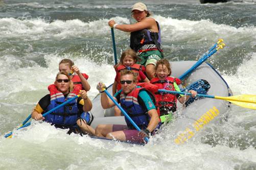
We have always taken the most popular run (Brown’s
canyon) as it’s reasonably safe for the uninitiated and
children older than 6 or 7 years (last year was Carina’s
second year at just 6) but still fun for older kids and
adults. But, it’s not just a smooth ride down the "lazy
river"! Of course this is not cheap, probably 60 bucks or so
for adults and half that for kids, so you do it one time per
year. This year I intend to bring my own inflatable
whitewater kayak and try some of the runs myself (I’m gonna
buy a tandem, so I’ll need a victim to come with me!).
This is one of the rougher sections of the river that
the commercial trips run...
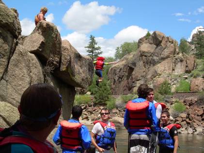
Here’s Christi jumping off the famous jumping rock…
There are two or so commercial outfits that run horseback
riding expeditions. We’ve tried 2 different ones, with
varying degrees of satisfaction. Sometimes trail permission
changes mean that some trip you took the year before is no
longer available, so this is more of a hit and miss
proposition than the river rafting. But we have one child
who we’d not be able to pry out of the valley if she didn’t
get to ride so we always do something. Last year we used an
outfit in Cottonwood Canyon west of Buena Vista. They had
nice trails and would even let you gallop the horses. Girls,
you’ll love it (so they tell me), guys, consider wearing a
cup or a speedo underneath!
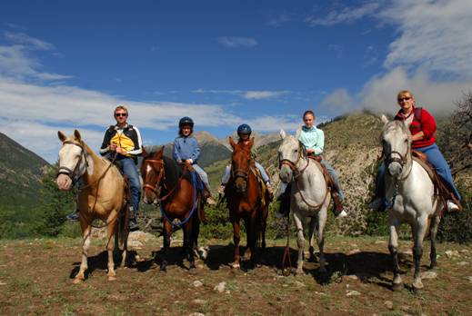
The family horseback riding photo…
Believe it or not, I have a family of rockhounds. So, we
spend at least a few days out of our usual 2 weeks looking
for interesting rocks/mineral specimens in the area. It
turns out that the mountains around the Upper Arkansas River
Valley have one of the most concentrated mineralized areas
in the US, so the picking is ripe! We’ve read all the guide
books and checked out most of the locations that are
"public". We often go back home with a 5 gal bucket of
samples, although you don’t have to do that to have fun.
Some of the locations require a little bit of hiking, though
most you can drive right up to with a 4wd vehicle, or even
2wd with good ground clearance. The list of things you can
collect includes: high quality granite (like for statues and
trophies), marble (more carving), iron minerals, tourmaline,
quartz crystals, olivine/peridot (a green gemstone),
feldspar crystals, and rose quartz.

Marble Quarry… This is in the same area that the very
first photo was taken. We’re up behind (east) of Salida.
Very interesting geology here, but that tends to bore most
people. Several of the rockhounding locations are all in
this area.
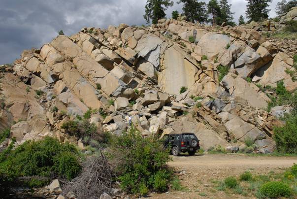
"Salida blue" granite quarry, commercially quarried in
the past. Good yard boulders now…
Moderately Strenuous activities:
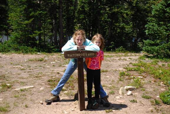
This is the domain of what we call "the family hike". I
usually come with the plan to hike/climb a new 14’er or two
every year, but I need a warm up hike to build my
acclimatization, so I tend to try and drag everyone else
along too. We have one favorite that we always do, called
waterdog lake. It’s about 1000 ft vertical climb over a
couple of miles to a pretty lake (actually there are several
lakes further back in if you are willing to go a little
further). The only requirement is that EVERYONE MAKES IT, no
wimping out. Basically it’s a good filter, if you can’t make
this one, don’t bother with any dreams of trying to do a
14’er as they are all at least a factor of 4 harder. One
nice thing about this hike is that there are often nice
wildflowers up by the lake.
Strenuous activities:
What vacation would be complete with out some brutal
physical exercise? Well, you are in luck in the Arkansas
Valley. I can think of several activities to get your heart
pounding. Given the mountains, of course number one is to
climb a 14’er. Now, the Sawatch range is the highest in
Colorado and the highest in the Rockies. But, fortunately
for us "most of the year flatlanders", the 14’ers here are
the easiest in Colorado and you will be hard pressed to find
meaningful technical routes, most routes are walk-ups and
have at most a bit of scrambling at the summit. I’ve climbed
(from easiest to hardest), Mt Shavano, Mt Elbert (the
highest in CO),Mt Antero, Mt Belford, Huron Pk, Mt Yale, Mt
Princeton, La Plata Pk, Tabeguache Pk (you have to climb
Shavano first, then descend 1000 ft, then back up 1000 ft
and then all that in reverse going back home!), and finally
Mt Harvard. All my pictures from those are on slides, not
digitized yet… There’s also a nice 13,988’ mountain called
Ouray Pk south of Mt Shavano that nobody climbs so it makes
a nice hike in complete solitude. I still need to climb Mt
Columbia, Missouri Mt, Mt Massive, and the Mt of the Holy
Cross to get all the 14’ers in the Sawatch range. Many of
the trails lower down on those mountains allow mountain
bikes, and there is no shortage of dirt/jeep roads for
mountain biking. The paved roads over some of the mountain
passes make nice road-bike hill climbs, although the busier
roads are probably too dangerous to do routinely. I have
climbed Monarch Pass and it was a great but scary ride. Not
enough exercise yet? There’s a foot race run in the valley
every year called the Leadville 100. 100 mile run that
crosses several mountain passes and never goes below 10,000
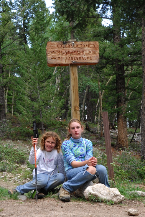
ft elevation! There are many good trails for running. I run
a bit of the Colorado trail by Mt Shavano to get
acclimatized, and some of the 14’ers can be run,
particularly Mt Antero.
The record for running all 51 colorado 14’ers is about 13
days and some hours, with a total cumulative elevation gain
of more than 300,000 ft.
Finally, there’s a good lap swimming pool in Salida, 25
meters, deep water.
Just at treeline on the way up Mt Shavano…
That’s the summit of Mt Shavano in the background, but the
weather was getting worse (and there’s still 1000 vertical
feet to go).
Katie and Christi on Esprit Pt, 13,600. We had to stop our
ascent of Shavano due to building weather (see the gray
cloud, lightning is the biggest risk up here)
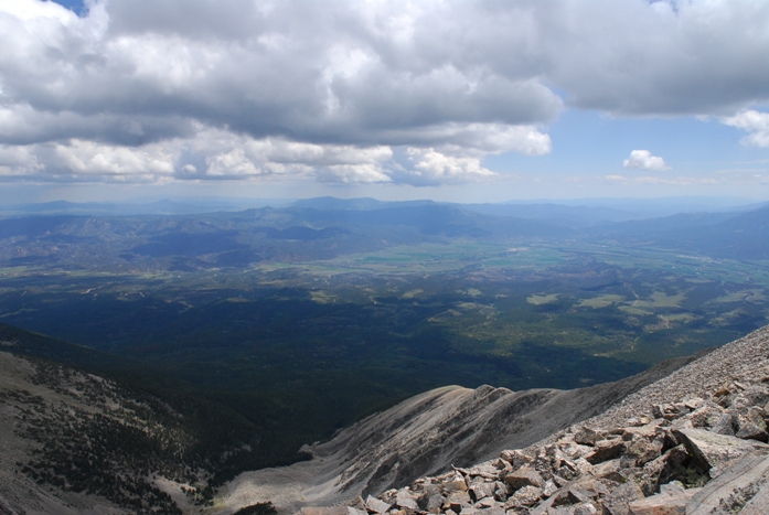
The view from Esprit Pt. Sittin’ on top of the world. Pike’s
peak 100 miles away is visible.
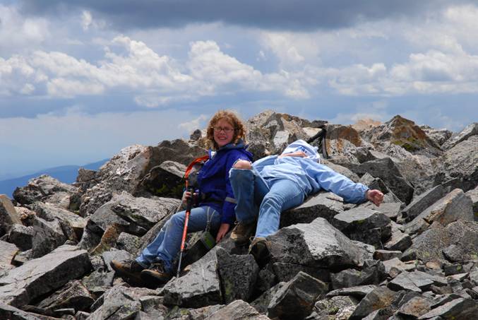
Back down at the trailhead. Christi’s exhausted, but
Katie is energized as this is the highest she’s ever
climbed…
More weird activities:
That’s not all you can do, I have two more favorites.
Gold prospecting and taking pictures of wildflowers. The
Colorado Gold belt goes right through the valley, and so
there’s excellent placer gold in the Arkansas river as well
as a few other areas. Most people are familiar with
"panning" where you take a bunch of sand and gravel and
"swirl" it around in a pan and wash out everything but the
gold. As you can imagine, there is a bit of a technique to
it and you can’t just slop it all around and expect to get
any gold. In addition, there are some better ways of getting
more gold from the ground. The simplest technique beyond
panning uses a sluice to wash away lighter materials from
heavy materials (gold, plus some other minerals). Here you
let the river do part of the work for you. You dig, the
river "washes".
Finally there are 2 "motorized" ways to get even more
gold, dredging and high-banking. A dredge is an underwater
vacuum cleaner that sucks up sand and gravel and runs it
through a sluice to separate out the gold. A highbanker is
similar, but is used on land, rather than in the river. You
shovel in material that then gets washed by the sluice and a
gas powered pump supplies the water. I have a combination
dredge/highbanker that I use on the Arkansas and in the
surrounding areas. I do find gold! Not enough to make a
living of course, but enough to have something worth looking
at. The main thing you have to be willing to do is get wet
and or dirty!
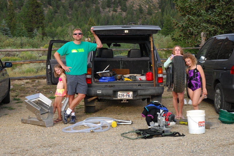
Here’s the gold prospecting "stuff"
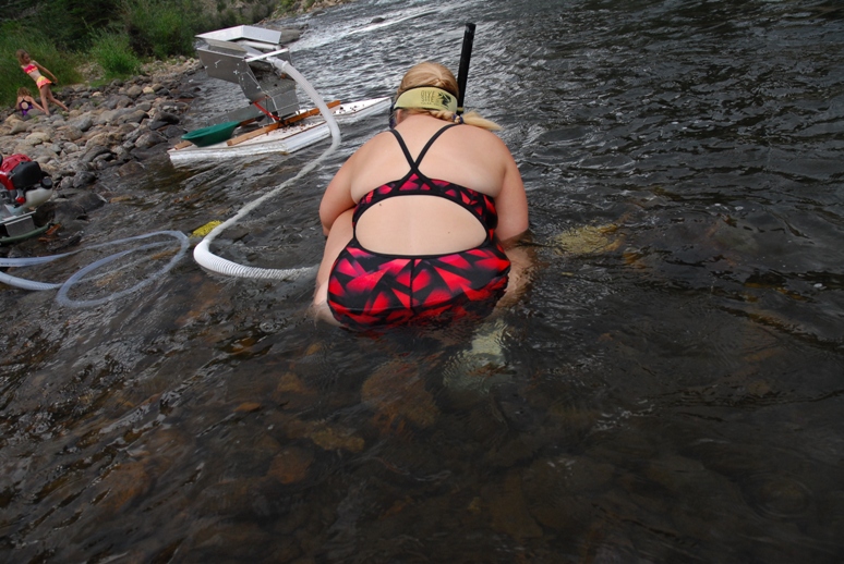
Here’s someone running the dredge nozzle. The kids are
playing in the river upstream…
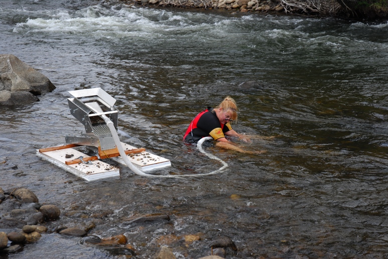
More good dredging…
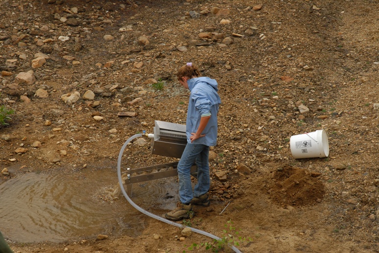
Here’s Christi checking the highbanker for nuggets…
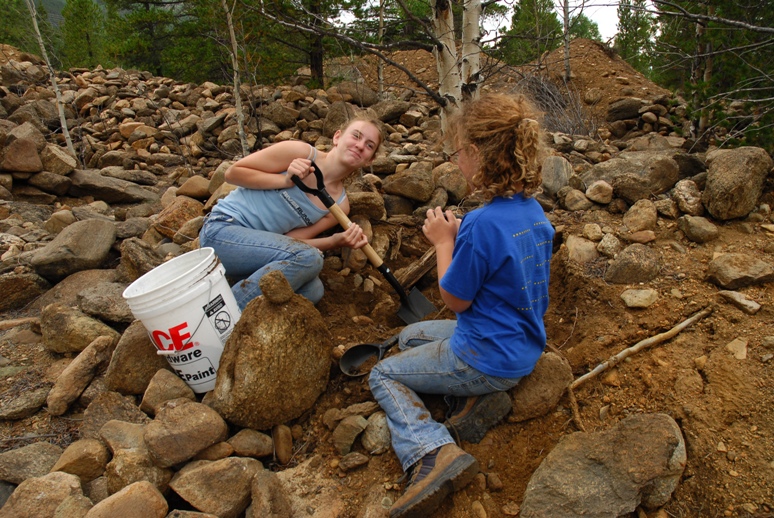
Christi and Katie digging up material to run through the
highbanker. This was the most productive surface placer mine
in Colorado up to 1911
When environmental problems shut them down…
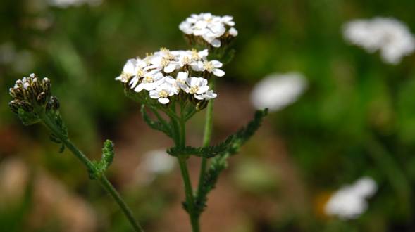
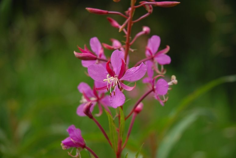
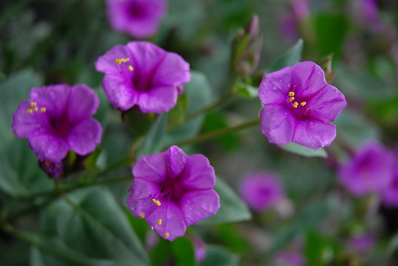
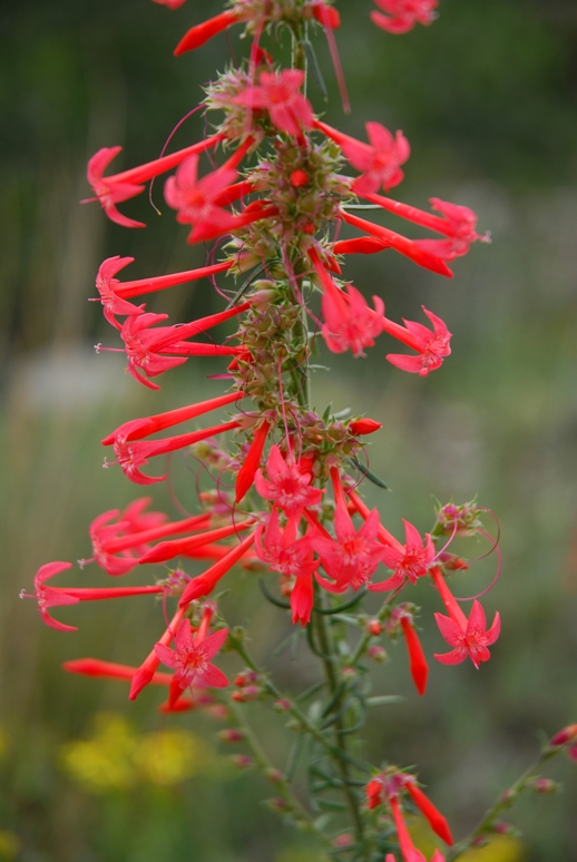
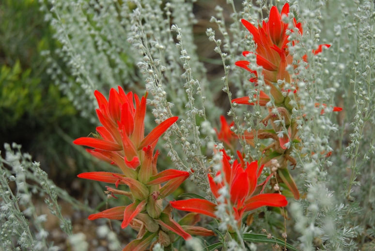
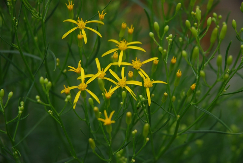
Wildflowers:
|